Santo Antônio de Pádua - Brasil
| Map | |
|---|---|
| |
| Coat of arms | |

| |
| Statistics | |
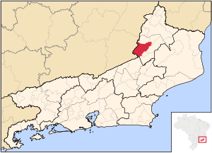
| State: | Rio de Janeiro |
| Meso-Region: | Northeastern Rio de Janeiro Nordeste Fluminense |
| Micro-Region: | Santo Antônio de Pádua (seat) |
| Founded: | July 26, 1883 |
| Location: | 21.539/21° 32' 20" S lat.
42.178/42° 10' 48" W long. |
| Postal code: | 28470-xxx |
| Name of inhabitants: | Paduano |
| Distance from the state capital: | 265 km north |
| Politics | |
| Mayor: | |
Santo Antônio de Pádua (first part, Portuguese meaning "Saint Anthony") is a municipality located in the northeastern part of the Brazilian state of Rio de Janeiro. Its population was 42,078 (2005) and its area is 612 km².
Contents |
Districts
- Santo Antônio de Pádua (seat)
- Baltazar
- Campelo
- Ibitiguaçu
- Marangatu
- Monte Alegre
- Paraoquena
- Santa Cruz
Neighboring municipalities
Coat of arms
The coat of arms of Santo Antônio de Pádua features eight stars representing eight of its districts on a navy blue field of the shield with a tree on the right and a fountain in the middle. The municipality's name is centered in the shield and it runs diagonally from bottom left to top right. The shield is bordered with four orange rectangles on each side. The crown is on the top of the coat of arms.
- (Portuguese) Santo Antônio de Pádua City Hall